Flickr image 4.5 MB or click on image below
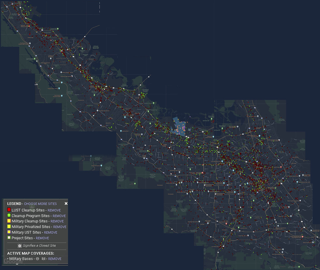
Silicon Valley Composite image of GeoTracker map showing toxic waste sites. Geotracker uses Google images.
The Navy Nuked San Francisco
Flickr image 4.5 MB or click on image below
Silicon Valley Composite image of GeoTracker map showing toxic waste sites. Geotracker uses Google images.
“The Site covers approximately 0.9 acre and was used for an orchard and flower growing business. Sequoia Union High School District (SUHSD) purchased the Site and planned for construction of a school facility for a charter school. The construction consisted of classrooms, a gymnasium and paved parking areas. The school campus is an expansion of the adjacent campus at 1010, 1020, 1040 and 1056 Myrtle Street (Site Code 204238) that was cleaned up under DTSC’s oversight in early 2011. In September 2013, SUHSD entered into a voluntary cleanup agreement with DTSC for cleanup of the soil contamination. The Site was cleaned up by soil excavation, capping and offsite disposal. Soil contaminated with arsenic, lead, dieldrin and DDT was excavated from classroom building locations and consolidated in a 0.5-acre area onsite that will be used for parking and gymnasium. Approximately 305 cubic yards of excess contaminated soil that cannot be used onsite was disposed of to a permitted landfill. The Site cleanup and school construction was completed in September 2014.” Continue reading “East Palo Alto – MYRTLE STREET HIGH SCHOOL CAMPUS PHASE 2 (60001925)”
