If the State and the Feds cannot look out for its own people how can we rely on them to protect the public?
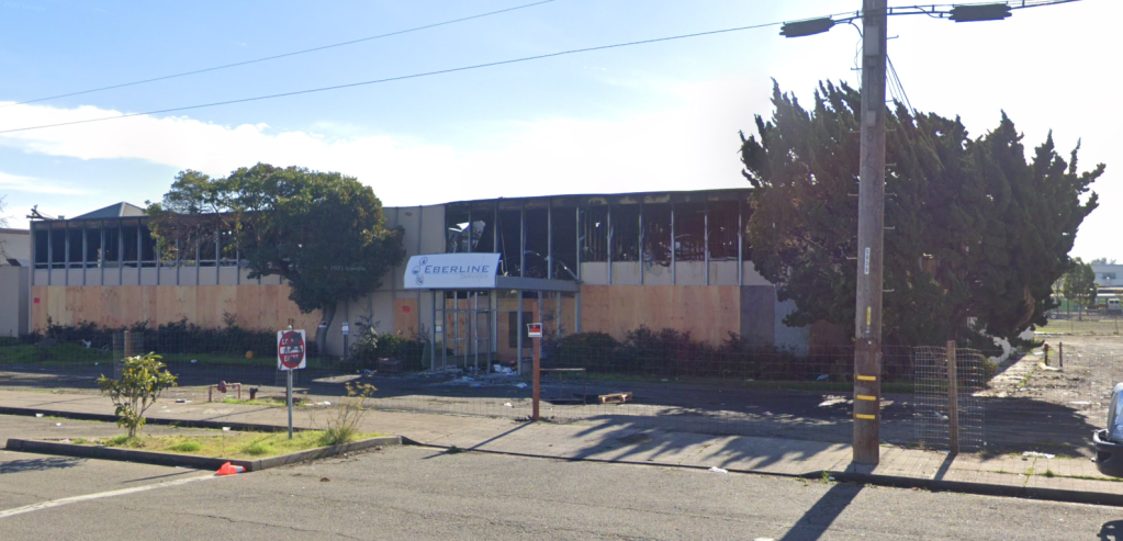
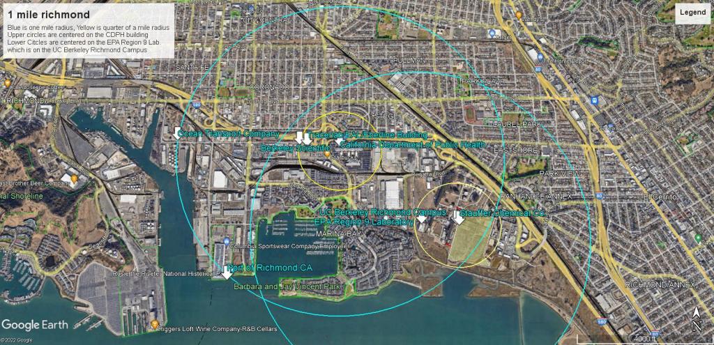
The Califormia Department of Public Health (CDPH) regulates all of the radiological contamination in the State of California. The California Department of Public Health (CDPH) Building, EPA Region 9 lab and the University of California Berkeley Richmond Campus are located right in the heart of Nuclear Alley in Richmond CA. This series will highlight 6 nuclear industry companies in the Port of Richmond that held Atomic Energy Commission Licenses for Nuclear Waste, worked directly with radioactive isotopes (radioactive elements like Uranium, Plutonium, Strontium 90, Cesium 137, Cobalt 60, Carbon 14 etc) and built machines used in the Nuclear Weapons industry.

All are within walking distance of these government facilites and they have never been cleaned up for their nuclear purposes. These government facilities need to be evacuated, because they were constructed after the contamination, which means:
- Every surface exposed during contruction inside the walls and out will have to be swabbed to determine alpha and beta particles for identification of the isotopes as well as gamma readings for radiation.
- All samples taken as evidence for all of Region 9 which includes, CA, OR, WA, HI, NV, the Pacific and the 148 Tribal Nations in all cases where the EPA and CDPH buildings have existed will have to be thrown out and resampled.
- And most importantly every employee and every living being who stepped in these facilties will have to be evacuated and monitored for exposure for the rest of their lives.
Also note the Navy dumped nuclear waste directly into San Francisco Bay in 1946 and they covered it up by making sure to not notify the barge operators what they were dumping. Here is that COVER UP Document and a separate set of orders for all Navy Bases on the West Coast, the Pacific and Norfolk Naval Bases.
Safety Regulations have changed over the years and all sites cleaned up in the past, those standards are nuclear accidents today. All sites need to be re-evaluated for radiological contamination.
EPA Regulations on proximity means the UCSF and UC Berkeley Ergonomics Lab is within 200 feet of the Stauffer Chemical Plant making it part of the site.
The EPA has regulations on Proximity to toxic waste sites. I went into the law in detail in this article on the contamination range of Treasure Island to San Francisco.
To the EPA everything within 200 feet of a site is on the site. In this case of UC Berkeley everything to the east of Egret Way, which is where the UC BErkeley Bus drives down to unload students is within the 200 feet fo the Stauffer Chemical Company.
Near Neighbors are everything from 200 feet to a quarter of a mile and that makes the EPA Region 9 Laboratory within that range.
A Second Near Neighbor class is everything from a quarter of a mile to a mile away and that encompases the California Department of Public Health.
Then you have ranges for water and dust contamination that can go 4 miles, so these sites are all within a mile of the California Department of Public Health and all sites are within the wind range contamination of each other and the city of Richmond.

You must be logged in to post a comment.